
Because the CK&N had built a considerable network of routes around Kansas, Nebraska and Colorado; this connection was desired to give the Rock Island access to Denver. The Rock Island purchased the CK&N in 1890.
Trackage rights were secured to cross the Missouri River on the Union Pacific Bridge into Omaha, before the route turned southwest, running through Papillion and Richfield, before crossing the Platte River at South Bend.
From here, the route continued through Murdock, Alvo and Prairie Home. By 1892, the Rock Island had reached Lincoln, skirting the east side of the city.
In 1893, work continued south, and the route was built through Rokeby, Hallam, Clatonia, DeWitt and Plymouth before finally reaching the existing line at Jansen, Nebraska.
The Rock Island was a poor railroad, facing financial trouble regularly and often in bankruptcy. This route hosted passenger trains known as "Rockets" for many years, although that traffic eventually dried up.
After World War II, the Rock Island struggled to survive, proposing mergers and deferring maintenance on their routes. Rock Island sought to keep interchange traffic between Denver and Chicago running on this line, struggling to compete with a stronger and better built Union Pacific system.
By 1964, the Rock Island began attempts to merge with Union Pacific, and restructure railroads west of the Mississippi River. This merger was eventually denied, and Rock Island turned its last profit in 1965.
In the mid-1970s, the railroad was in serious decline. The railroad received loans to attempt to fix slow orders, received new equipment and turn a profit. By 1978, the railroad came close to profit, but creditors were lobbying for a complete shutdown of the Rock Island.
During the fall of 1979, a strike crippled the railroad, and by January of 1980, the entire system was ordered to be shut down and liquidated.
Many of the lines and equipment were scrapped. Profitable sections of railroad were prepared for sale. The route between Hallam and Omaha was abandoned. The route between Jansen and Hallam was sold to Mid States Port Authority in 1984, and began operations under Union Pacific the same year.
Today, UP owns the surviving part of this line and operates it as the Hallam Subdivision. The line through Lincoln is now the Rock Island Trail, and plans are being made to extend the trail to US-77.
East of Lincoln, a small segment is now the Dave Murdock Trail, and the Platte River Bridge is now part of the Mopac Trail. The remainder of this line is now privately owned and abandoned.
06/26/21
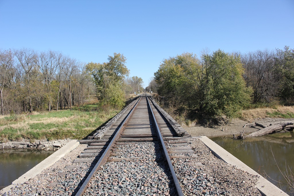
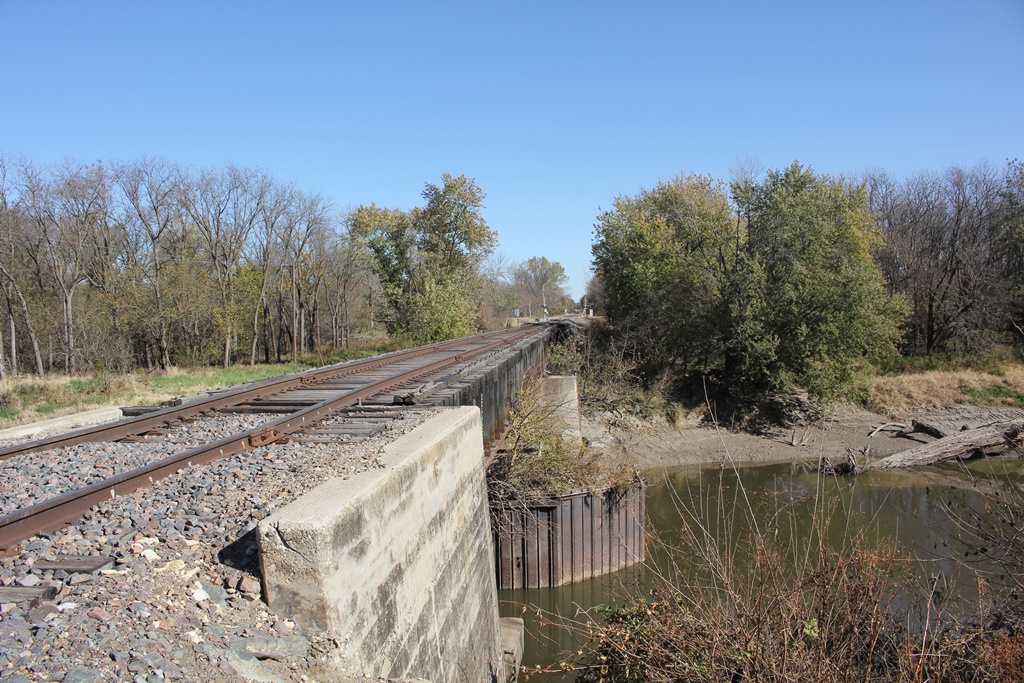
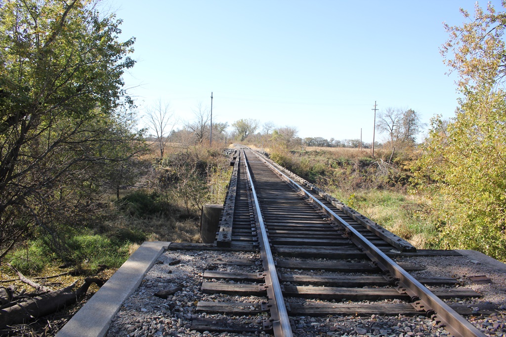
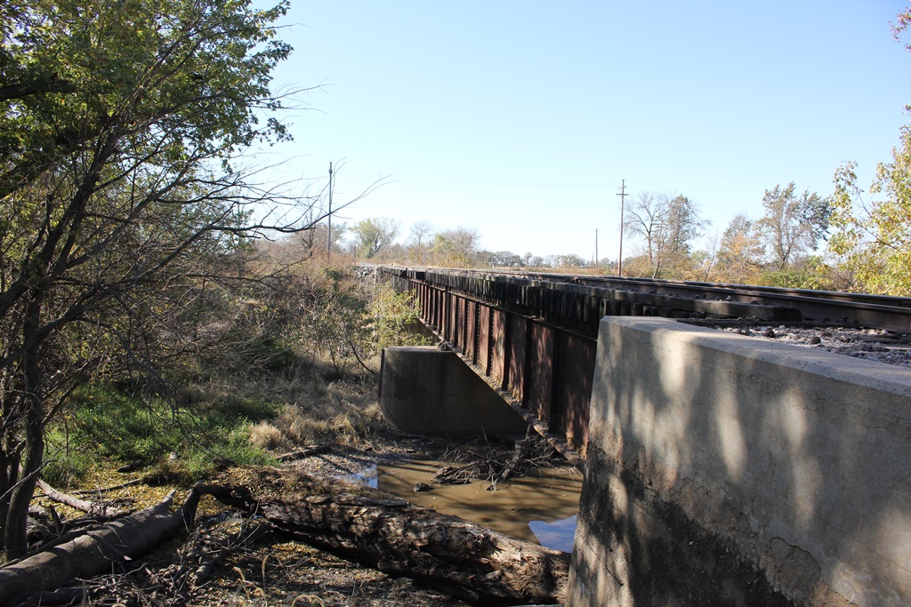
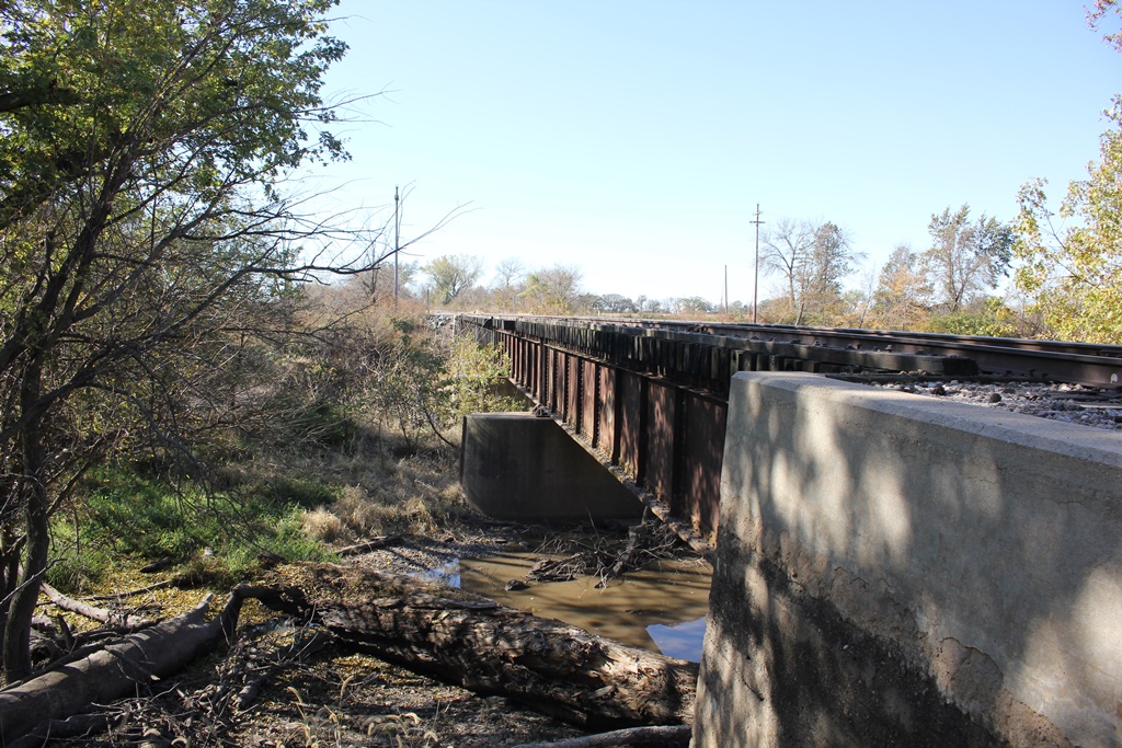
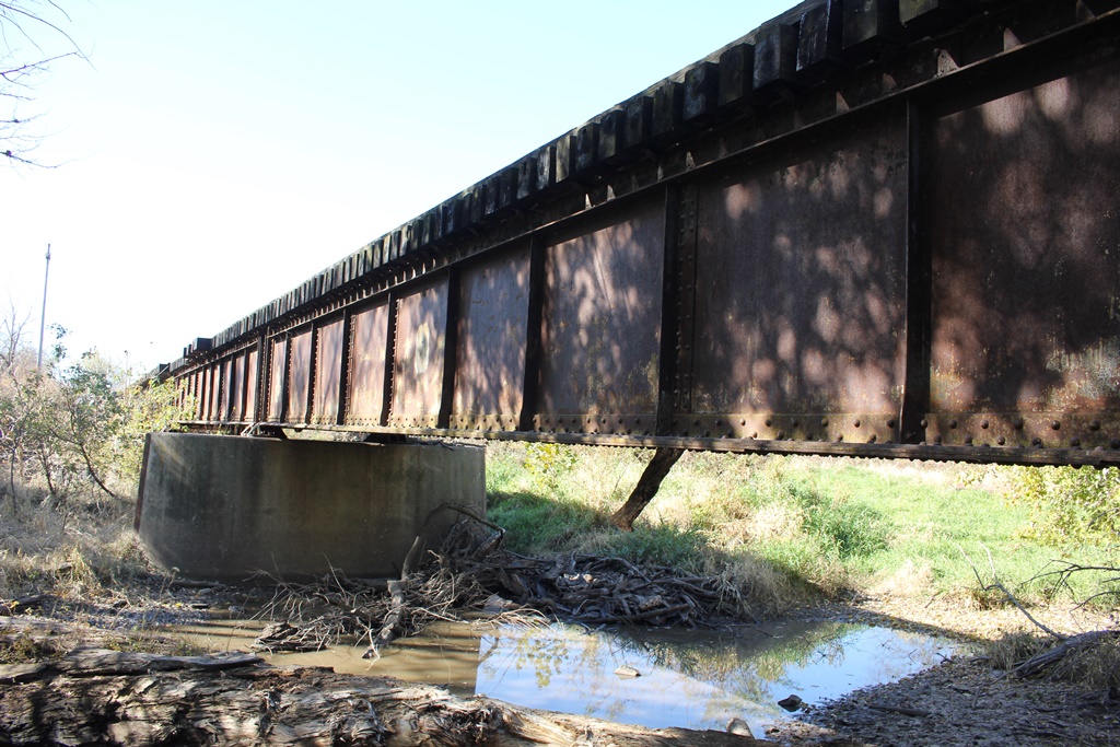
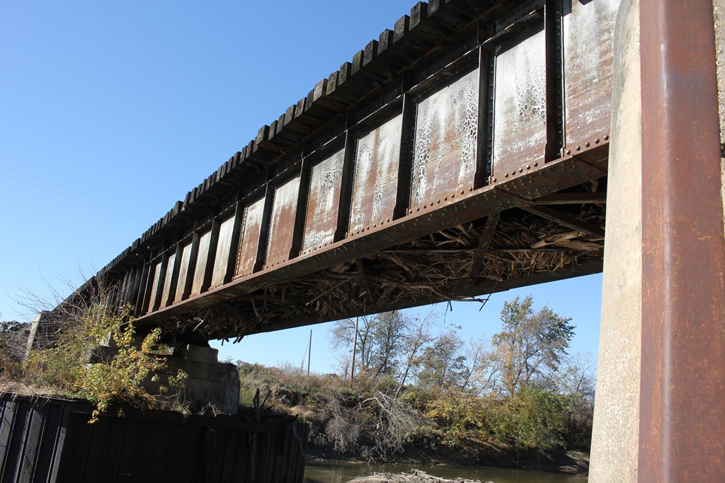
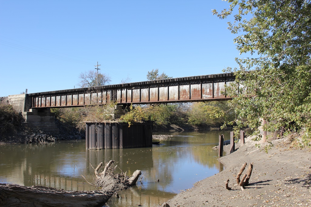
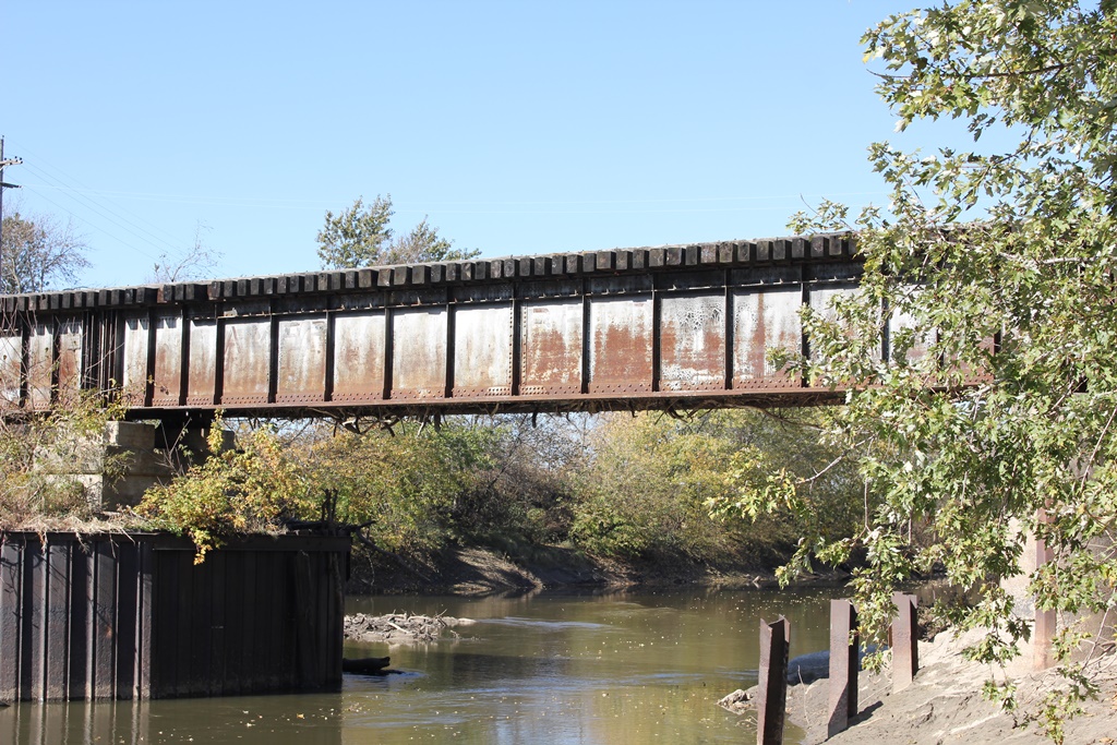
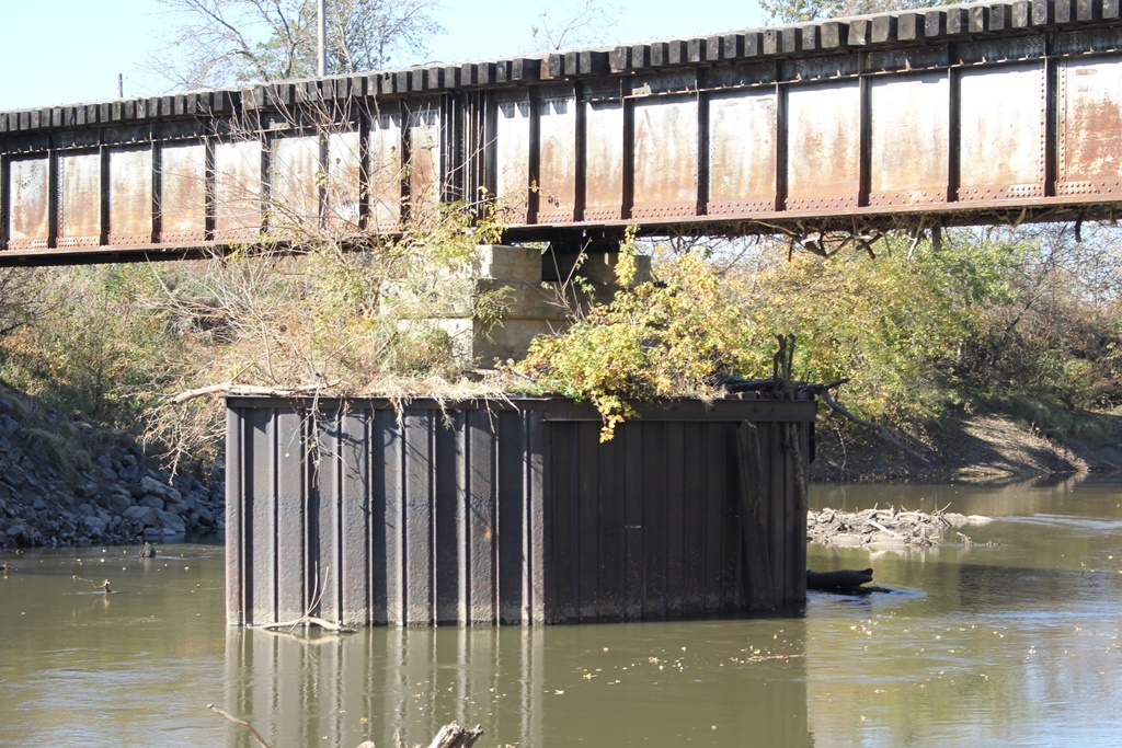
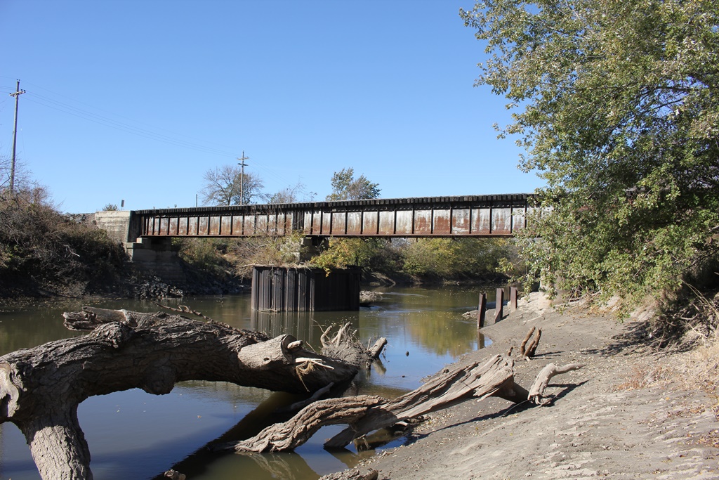
Located near Chestnut Road, this large deck girder bridge crosses the Big Blue River and is one of a series of three similar bridges in the immediate area.
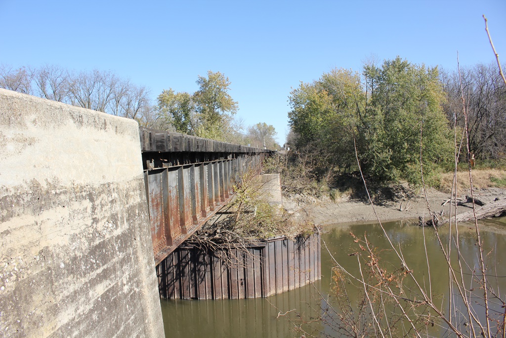
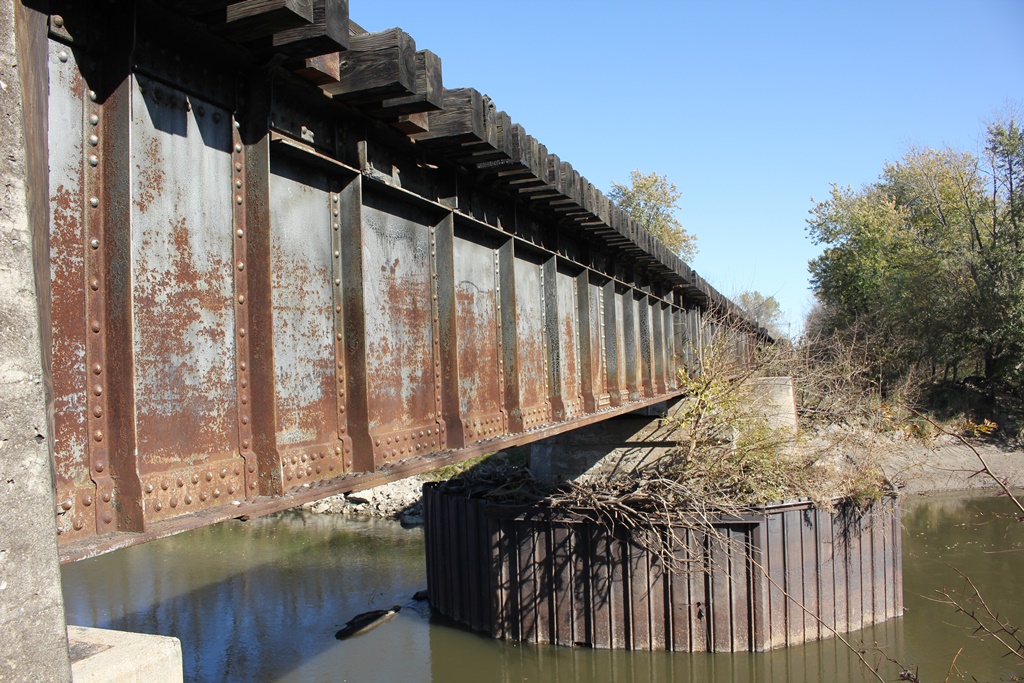
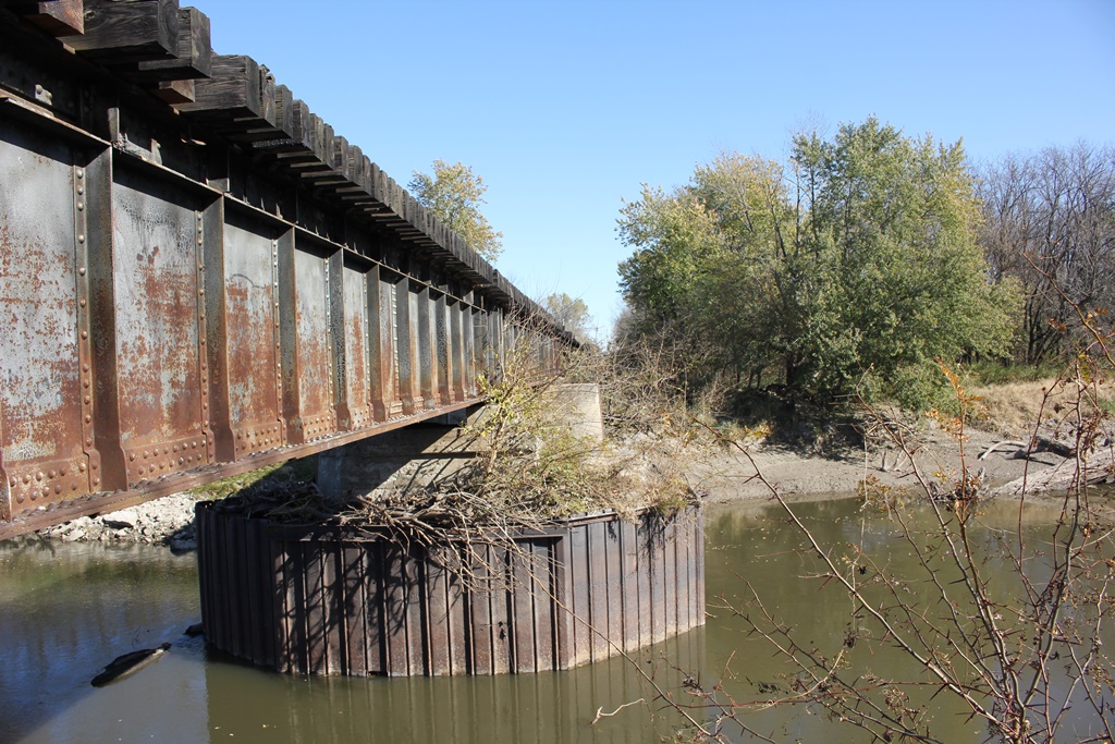
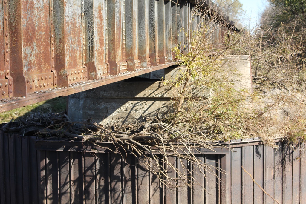
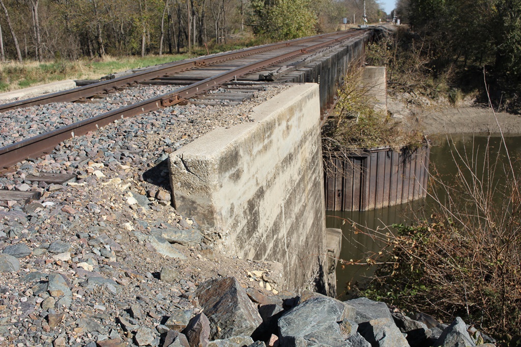
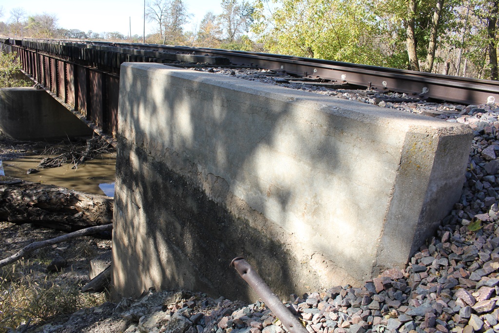
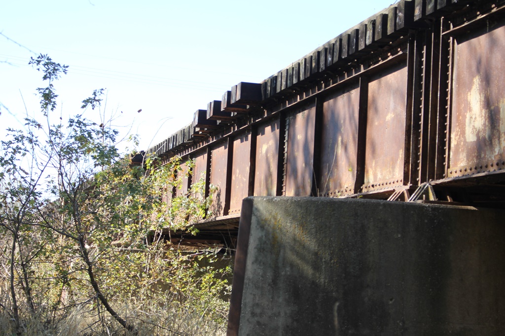
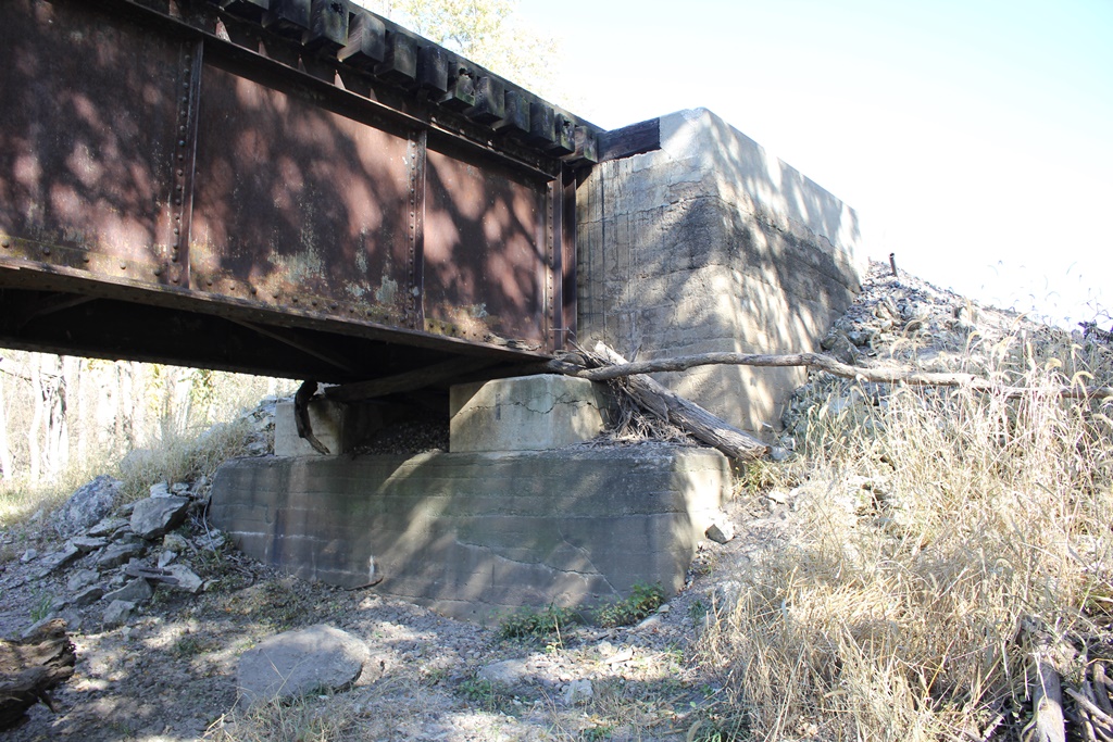
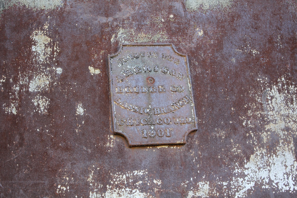
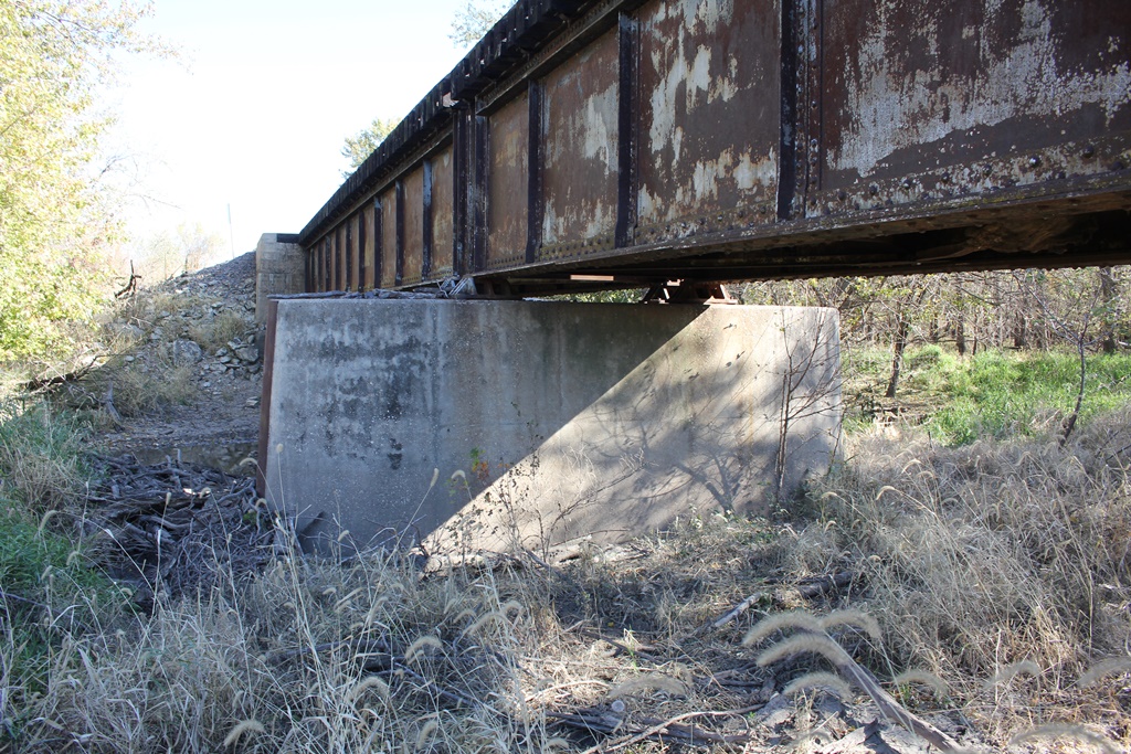
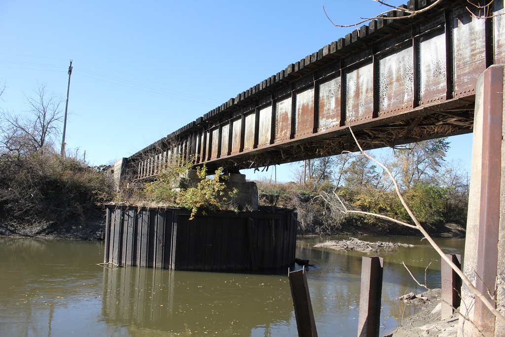
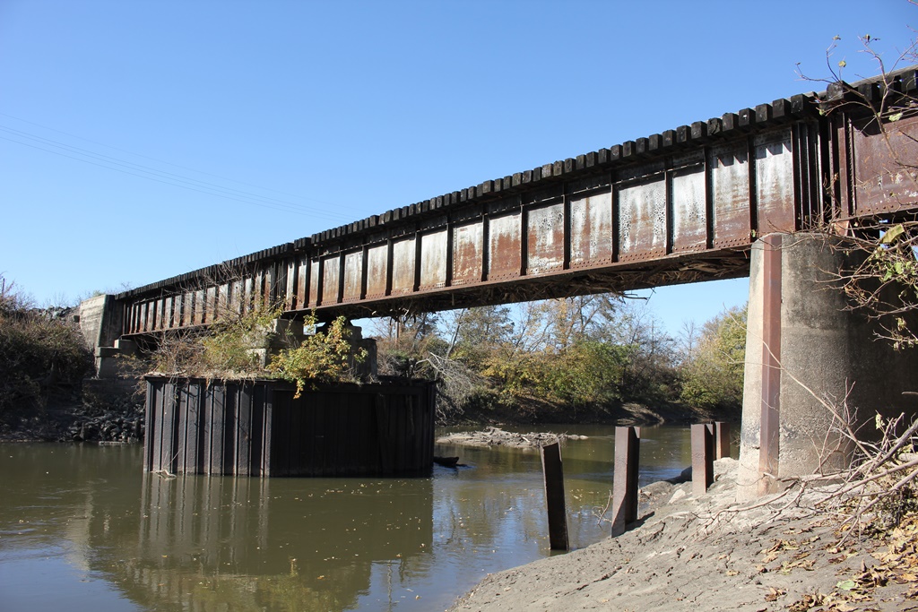
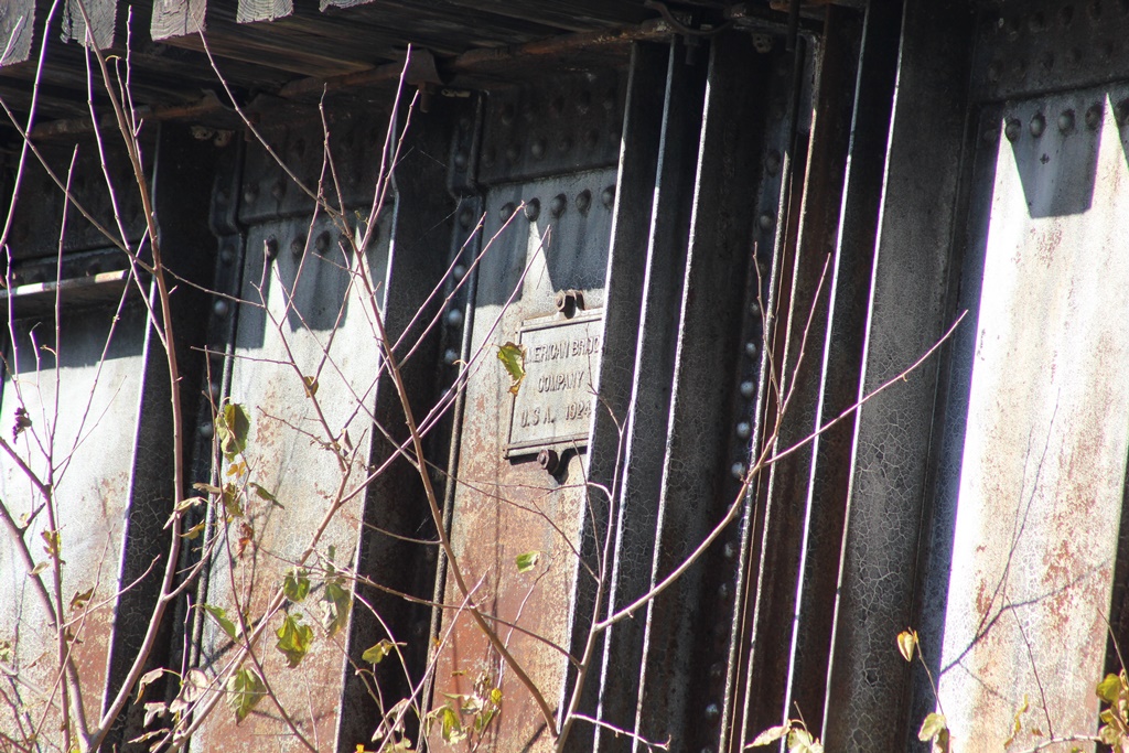
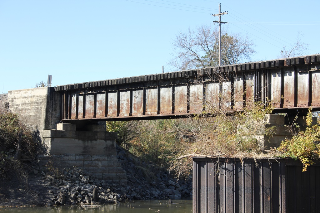
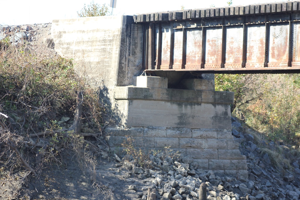
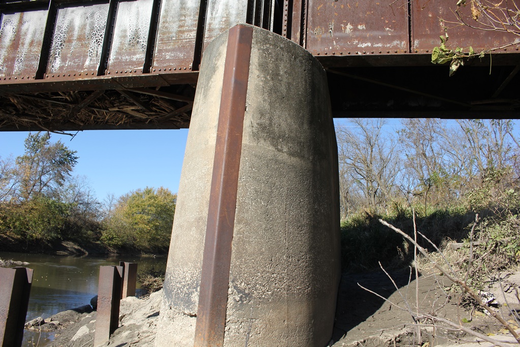
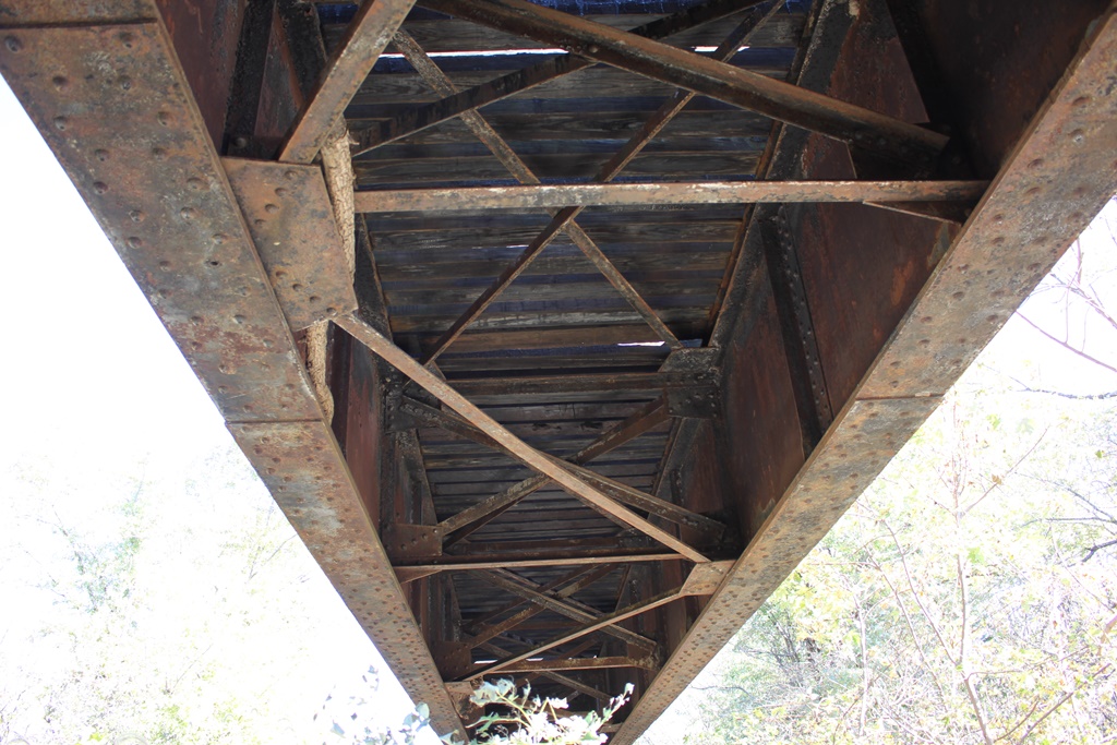
Originally built in 1901, the bridge features four deck girder spans. In 1924, the southern two spans were replaced with newer identical spans. The bridge rests on concrete and stone substructures.
The two build dates (1901 and 1924) are very similar to the Turkey Creek Bridge less than a mile away. That bridge also had spans replaced the same year, and features both stone and concrete substructures. The northern two spans are also shorter than the southern two spans. In addition, the abutments are large concrete parapet style structures.
Spans like this are common for small to medium sized waterway and roadway crossings. Simple to construct, they are also easy to maintain and will last 100 years or more.
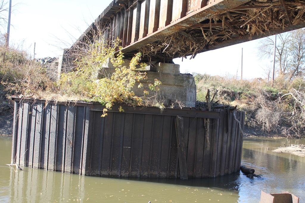
This bridge is unique because of the upgraded deck girders. While both sets of spans are both approximately the same depth, the two channel spans were replaced for an unknown reason. It is possible that a flood knocked them out, evidenced by the center and north piers, which are rounded concrete structures often seen on Rock Island bridges built in the 1920s.
The southern pier has also been reinforced with sheet piling, but appears to be a typical ca. 1901 concrete pier with squared edges. The sheet piling has created an island, with trees growing within it.
Furthermore, stone piers and abutments seem to be rather uncommon along this line. The south abutment has a stone base, but a concrete top that appears to date to around 1901. The north abutment appears to be the same 1901 vintage.
Overall, the bridge appears to be in fair condition. The sheet piling around the south pier needs to be redone to prevent tree roots from damaging the structure.
The author has ranked the bridge as being locally significant, due to the common design.
The photo above is an overview, looking at the south spans. Because the bridge is significantly treed in, it is impossible to get a photo of the complete structure.
| Upstream | BNSF Big Blue River Bridge (Crete) |
| Downstream | BNSF Big Blue River Bridge (Hoag) |